ATCS provided analyses of the 100,000-acre closed basin that drains an area of 3,810 square miles. ATCS provided the FEMA Regional Office with engineering, complete database management, project management, and mapping; implementing LIDAR digital mapping of elevation data, aerial photographs, and GIS technologies in defining various lake elevations that impact the residential, commercial, and public structures in the vicinity of the closed basin.
https://atcscorp.com/wp-content/uploads/News_The-Devils-Lake-Flood-Impact-Study-North-Dakota.jpg580930Website Administratorhttps://atcscorp.com/wp-content/uploads/ATCS-logo-2022-NAVY-header-340x156-small.pngWebsite Administrator2015-12-14 17:46:562021-06-01 09:35:12The Devils Lake Flood Impact Study, North Dakota
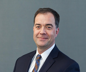
Executive Vice President, Corporate Services and Chief Finance Officer
Tamir Sherif is Executive Vice President, Corporate Services and Chief Finance Officer at ATCS. He brings over 20 years of private-sector banking and financial expertise, primarily in technology.
As a former chemical engineer who obtained his MBA, Mr. Sherif leverages his diverse experiences and perspectives to drive financial performance, manage risks, and support ATCS’ strategic growth objectives.
Mr. Sherif holds a Master of Business Administration from Ivey Business School in London, Canada, and a Bachelor of Science in Chemical Engineering from Queen’s University in Kingston, Canada.
Mr. Sherif is an avid foodie who once owned a pub and live music venue.
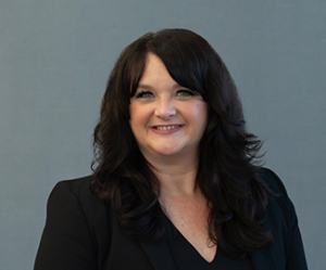
BRENNAN COLLIER, AICP
Senior Vice President, Strategic Sales
Brennan Collier is Senior Vice President, Strategic Sales at ATCS. In this position, Ms. Collier oversees ATCS’ strategic engagement and communications functions of business development, sales, marketing and communications, and public involvement. Her responsibilities include guiding strategic decisions on pursuits and teaming arrangements for procurements in ATCS’ target areas.
In 2021, Ms. Collier became ATCS’ first female owner among a group of 11 owners.
Previously, Ms. Collier was Vice President of Environmental Services at ATCS and was responsible for building a team focused on assessing the potential environmental impacts of proposed projects and ensuring regulatory compliance.
Ms. Collier brings over 26 years of environmental compliance experience in the transportation industry. Before joining ATCS, she served in roles with state and federal governments and consulting firms in Virginia, including nearly six years with VDOT in the Northern Virginia District and Central Office.
Ms. Collier is a certified planner holding the AICP designation. She is an active member of the Virginia Transportation Construction Alliance (VTCA) and was recently elected chair of VTCA’s Engineering Consultant Leadership Committee (ECLC). In addition, she is involved in WTS International, an organization focused on advancing women in the transportation industry. She serves on the WTS Southeast Region Council, a liaison to the WTS chapters in a 10-state region, including her local Central Virginia Chapter. Ms. Collier holds a Bachelor of Arts in Environmental Science and a Bachelor of Arts in Geology from George Mason University in Fairfax, Virginia.
Ms. Collier enjoys running, Pilates, traveling, honing her skills as an amateur oenophile, and relaxing with her daughter on the bay in Cape Charles.
GREGG NEWHOUSE, PE, CCM
Senior Vice President, Construction Services
Gregg Newhouse is Senior Vice President, Construction Services at ATCS. In this position, Mr. Newhouse oversees and manages ATCS’ construction-related projects and services. He is responsible for the construction phases of projects, ensuring compliance with applicable standards and regulations, and providing technical guidance and leadership to project teams.
Mr. Newhouse has over 35 years of experience in the engineering and construction industry, with a particular focus on large, heavy civil transportation projects. His expertise includes site/civil, structural, geotechnical, and roadway design.
Mr. Newhouse is a registered Professional Engineer in Florida, Maine, Maryland, North Carolina, Pennsylvania, South Carolina, Texas, Virginia, Washington, D.C., and the Virgin Islands. He is also a Certified Construction Manager and a member of The American Society of Civil Engineers. Mr. Newhouse holds a Bachelor of Science in Civil Engineering from the University of Maine at Orono in Orono, Maine.
Mr. Newhouse is a sports enthusiast, traveler, and learner who supports the Patriots, Bruins, Celtics, and Red Sox. As part of his bucket list, he and his wife aim to visit every major league baseball stadium. He is working on renewing his pilot’s license, learning to play guitar, and lowering his golf handicap.
MICHAEL J. ROSENFELD, PE
Chief Executive Officer
Michael Rosenfeld is Chief Executive Officer at ATCS, where he leads the company’s vision and growth strategy, driving innovation and expanding ATCS’ impact across industries and communities. With nearly 30 years of expertise in program delivery, project controls, and construction management, he has played a pivotal role in advancing operational excellence, enhancing collaboration, and strengthening ATCS’ culture of innovation.
Since joining ATCS in 2008, Mr. Rosenfeld has held key leadership roles, including senior vice president of program management and chief operating officer. He has led major contracts, including the Virginia Department of Transportation (VDOT) Engineering Support Services Contract, on-call design and construction management contracts in Prince William and Loudoun Counties, and multiple municipal programs.
Prior to ATCS, Mr. Rosenfeld served as the Northern Virginia District’s construction engineer and project controls manager for VDOT.
Mr. Rosenfeld is a registered Professional Engineer in Virginia. He holds a Master of Science in Civil Engineering from Manhattan College in Riverdale, New York, and a Bachelor of Science in Civil Engineering from the State University of New York at Buffalo in Buffalo, New York.
Outside work, Mr. Rosenfeld enjoys spending time with his wife and son, caring for their small farm in Northern Virginia, where they raise chickens, barn cats, beehives, a pony, and gardens. He has also completed the NYC Marathon twice and continues to enjoy distance running.
BRIAN RIFFEL, PE
Chief Operating Officer
Brian Riffel is Chief Operating Officer at ATCS. Joining ATCS in 2019, Mr. Riffel champions a collaborative, innovative, and passionate approach to propel ATCS’ growth.
With 30 years of experience in operations and project management, Mr. Riffel has established himself as an accomplished business developer and effective leader, skillfully directing successful sales cycles from start to finish. He has managed several high-profile projects and focused on alternative project delivery for highway and light rail transit projects.
Mr. Riffel is a registered Professional Engineer in Maryland, North Carolina, South Carolina, Texas, and Virginia. He is an active member of the American Society of Civil Engineers, the American Society of Highway Engineers, and the American Council of Engineering Companies. He has a Bachelor of Science in Civil Engineering from the State University of New York at Buffalo in Buffalo, New York.
Mr. Riffel is an expert in making world-class barbecue, with his approach deeply rooted in spending thousands of hours tending fires, designing recipes, and studying the science behind barbecuing.
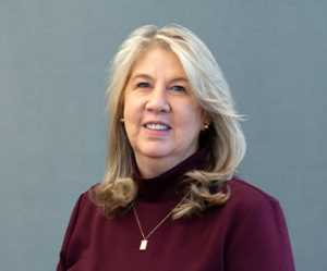
DEBORAH GARRETT
Vice President, Finance & Accounting and Controller
Deborah Garrett is Vice President, Finance and Accounting at ATCS. In this position, she manages ATCS’ financial operations, including financial reporting, budgeting, accounting, payroll functions, and government contracting compliance. She also serves as Controller.
Ms. Garrett is an active member of the American Council of Engineering Companies and the American Association of State Highway and Transportation Officials. She holds a Bachelor of Science in Accounting from Strayer University.
Ms. Garrett’s daughter is an avid horseback rider; ironically, Ms. Garrett is allergic to horses.
AMIR MASSOUDI
Vice President, Information Technology
Amir Massoudi is Vice President, Information Technology at ATCS. In this role, his responsibilities include providing corporate leadership in technology innovation and growth, cybersecurity, cloud computing, process automation, digital transformation, and overseeing fleet and facilities.
Prior to joining ATCS in 2019, Mr. Massoudi was Vice President, Information Technology Operations and Director, Infrastructure Operations at Cricket Media.
Mr. Massoudi holds a Master of Arts in Linguistics and an Associate of Science in Computer Hardware Engineering from Tehran University in Tehran, Iran. In addition, he has pursued course studies in a Master of Science in Information Technology at George Mason University in Fairfax, Virginia. He is a Microsoft Certified Systems Engineer (MSCE) and PMP candidate.
In his free time, Mr. Massoudi enjoys spending time with his family and friends, landscaping, and maintaining his yard. He is a devoted fan of his daughter’s soccer team – often cheering them on, rain or shine, from the sidelines.
SHERRI HUNTLEY, SPHR
Vice President, Human Resources
Sherri Huntley is the Vice President of Human Resources at ATCS. In this role, Ms. Huntley provides strategic leadership for human resource initiatives across ATCS – with a particular focus on Diversity, Equity, and Inclusion strategies. Her areas of responsibility include performance management, talent acquisition, professional development, and employee relations.
Prior to joining ATCS in 2018, Ms. Huntley held management and executive roles in human resources at Booz Allen Hamilton, and Raytheon. She began her human resource career at the Virginia Department of Transportation in the Northern Virginia District Office.
Ms. Huntley is certified as a Senior Professional in Human Resources (SPHR). She holds a Master of Science in Human Resource Management from Chapman University and a Bachelor of Science in Political Science from East Tennessee State University in Johnson City, Tennessee.
Ms. Huntley is a passionate reader and strong supporter of our local libraries – not surprising given her mother was a librarian.